User manual
-
Key areas of Digimap for Schools
-
About the maps
-
Navigating in Digimap for Schools
-
Search
-
Map selector
-
View the compass
-
Save maps
- Drawing Tools
-
View Geograph images
-
View map keys
-
Overlays
-
Measure distance and areas
-
Capture geographic coordinates
-
Add your own data
-
Print maps
-
Map information
-
Edit your preferences
-
Tips and tricks
-
Try it out!
Drawing Tools
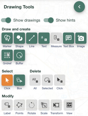
The Drawing Tools in Digimap for Schools enable you to personalize your maps, annotate features, and create informative visualizations.
Drawing Tools

Using these tools, you can:
- Add text labels to specific points on your map.
- Attach measurement labels to lines or shapes, making it easy to indicate distances or areas.
- Enhance your maps with symbols or emojis, using expressive icons to highlight features or points of interest.
- Draw lines with customizable colours, types, and widths.
- Incorporate predefined shapes (e.g., triangles) into your map, with options to specify stroke and fill settings.
Explore the following sections to learn more.
Watch the video
Watch the short video below for an introduction to the key features.


