User manual
-
Key areas of Digimap for Schools
-
About the maps
-
Navigating in Digimap for Schools
-
Search
-
Map selector
-
View the compass
-
Save maps
- Drawing Tools
-
View Geograph images
-
View map keys
-
Overlays
-
Measure distance and areas
-
Capture geographic coordinates
-
Add your own data
-
Print maps
-
Map information
-
Edit your preferences
-
Tips and tricks
-
Try it out!
View geographic images
You can search for and view images in Great Britain, Ireland and the Isle of Man from the Geograph project in Digimap for Schools.
Geograph project
Geograph® aims to collect, publish, organise and preserve representative images and associated information for every square kilometre of Great Britain, Ireland, and the Isle of Man. The images are freely available to the public.
Search for all images
- You can only search for all images when you are zoomed in to the five most detailed scales.
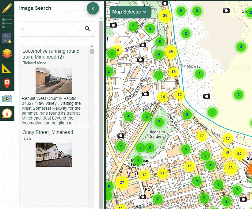
- Select the Image search tool from the sidebar.
- Type an asterisk * in the search box.
- All images at a location will be visible on the map window.
- if you are zoomed out too far, you will see a message: There are too many images to view. Try searching with a word or zoom in to a smaller area.
- A list of images is displayed in the Image Search area. Select an image from the results list to highlight it on the map window.

Search with a keyword
- You can search with a keyword at any scale.
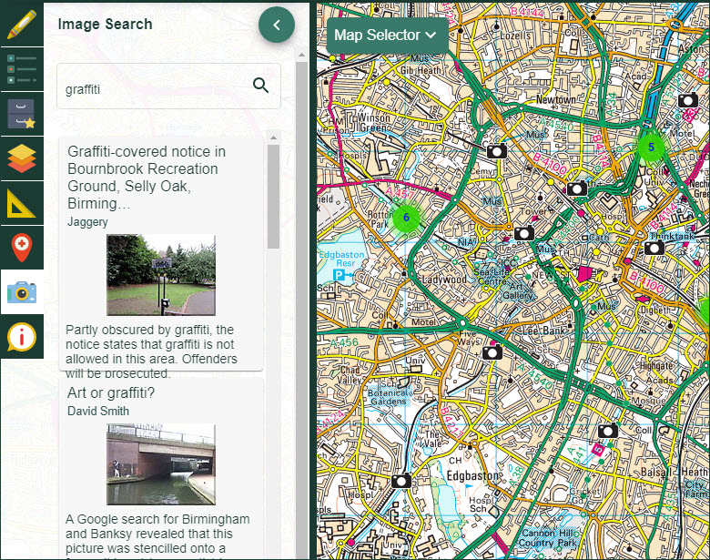
- Select the Image search tool from the sidebar.
- Type your keyword or words in the box.
- Select the magnifying glass.
- All images with your keyword will be visible on the map window.
- A list of images is displayed in the Image Search area. Select an image from the results list to highlight it on the map window.

Clusters of images
- You may see circles with numbers on. These denote clusters of images at a location.
- As you zoom in, the clusters will break into smaller clusters or individual images.
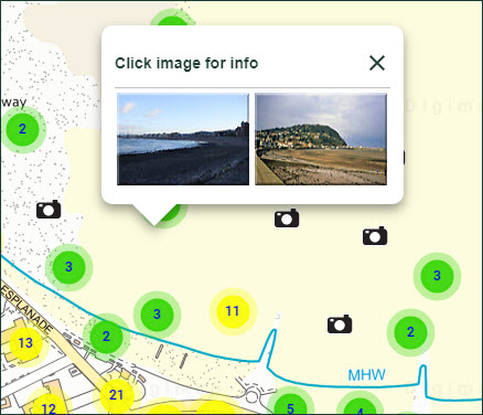
- Where a cluster remains, selecting it will generate a box showing all images at that location.
- Select any image from the box to view it.

View an image
- Select a camera icon on the map window.
- A box will open up with a small image.
- Select the small image to see a larger version, with details of the image location, photographer, date and title.


